جبال كونلون
| جبال كونلون | |
|---|---|
| 崑崙山 | |
|
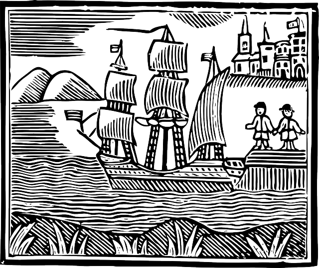
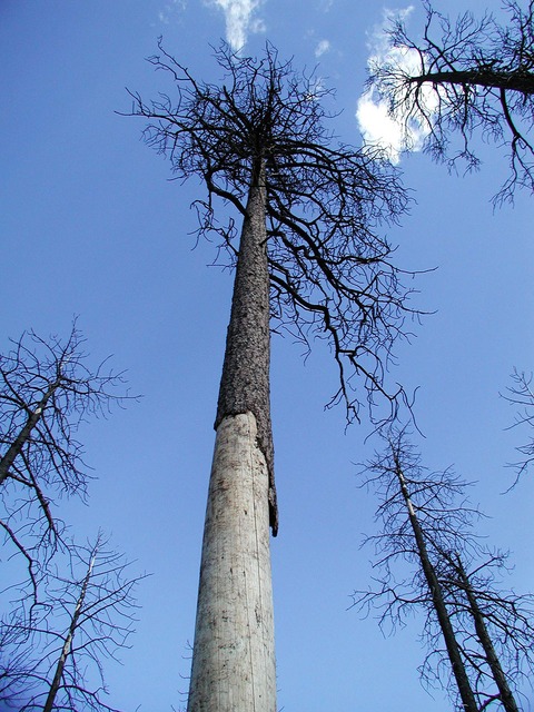
منظر جبال كونلون الغربية من طريق التبت-شينجيانگ
| |
| أعلى نقطة | |
| القمة | الإلهة كونلون |
| الارتفاع | 7,167 م (23,514 قدم) |
| البروز | P2660 |
| العزلة | P2659 |
| التسمية | |
| الاسم المحلي | Kūnlún Shān |
| الجغرافيا | |
خطأ لوا في وحدة:Location_map على السطر 502: Unable to find the specified location map definition: "Module:Location map/data/Tibet_Karte_Topograpisch.png" does not exist.
| |
| البلد | الصين |
| الولاية/المقاطعة | التبت، چينگهاي، شينجيانگ |
| يحد | صحراء گوبي |
| جبال كونلون | |||||||||||
|---|---|---|---|---|---|---|---|---|---|---|---|
| "كونلون" بالحروف الصينية المبسطة (أعلى) والتقليدية (أسفل) | |||||||||||
| صينية مبسطة | 昆仑山 | ||||||||||
| صينية تقليدية | 崑崙山 | ||||||||||
| |||||||||||
جبال كونلون (الصينية المبسطة: 昆仑山; الصينية التقليدية: 崑崙山; پنين: Kūnlún Shān، تـُنطـَق [kʰu̯ə́nlu̯ə̌n ʂán]؛ بالمنغولية: Хөндлөн Уулс Hundlun؛ بالإنگليزية: Kunlun Mountains) هي واحدة من أطول سلاسل الجبال في آسيا، تمتد لأكثر من 3,000 كم. وفي أعم وصف، فإنها تشكل الحافة الشمالية لـهضبة التبت جنوب حوض تريم ورواق گانسوويمتد شرقاً جنوب نهر وِيْ لتنتهي عند سهل شمال الصين.
The exact definition of this range varies. An old source uses Kunlun to mean the mountain belt that runs across the center of China, that is, Kunlun in the narrow sense: Altyn Tagh along with the Qilian and Qin Mountains. A recent source has the Kunlun range forming most of the south side of the حوض تريم ثم يمتد شرقاً جنوب ألتين طاق. سيما چيان (Shiji, scroll 123) says that الامبراطور وومن هان sent men to find the source of the Yellow River and gave the name Kunlun to the mountains at its source. ويبدوحتى الاسم نشأ كمسقط شبه أسطوري في النص الكلاسيكي الصيني شانهاي جينگ.
الامتداد
من جبال پامير في طاجيكستان، تمتد جبال كونلون شرقاً بحذى الحدود بين المنطقتين الذاتيتين شينجيانگ والتبت إلى سلاسل الجبال الصينو-تبتية في مقاطعة چينگهاي. وتمتد بطول الحد الجنوبي لما يسمى اليوم حوض تريم، the infamous Takla Makan or "sand-buried houses" desert, and the Gobi Desert. A number of important rivers flow from it including the Karakash River ('Black Jade River') and the Yurungkash River ('White Jade River'), which flow through the Khotan Oasis into the Taklamakan Desert.
ألتين طاق or Altun Range is one of the chief northern ranges of the Kunlun. Its eastern extension Qilian Shan is another main northern range of the Kunlun. In the south main extension is the Min Shan. Bayan Har Mountains, a southern branch of the Kunlun Mountains, forms the watershed between the catchment basins of China's two longest rivers, the Yangtze River and the Huang He.
The highest mountain of the Kunlun Shan is the Kunlun Goddess (7,167 m) in the Keriya area. The Arka Tagh (Arch Mountain) is in the center of the Kunlun Shan; its highest point is Ulugh Muztagh (6,973 m). Some authorities claim that the Kunlun extends northwest-wards as far as Kongur Tagh (7,649 m) and the famous Muztagh Ata (7,546 m). But these mountains are physically much more closely linked to the Pamir group (ancient Mount Imeon).
The mountain range formed at the northern edges of the Cimmerian Plate during its collision, in the Late Triassic, with Siberia, which resulted in the closing of the Paleo-Tethys Ocean.
The range has very few roads and in its 3,000 km length is crossed by only two. In the west, Highway 219 traverses the range en route from Yecheng, Xinjiang to Lhatse, Tibet. Further east, Highway 109 crosses between Lhasa and Golmud.
مجموعة كونلون البركانية
Over 70 volcanic cones form the Kunlun Volcanic Group. They are not volcanic mountains. As such, they are not counted among the world volcanic mountain peaks. The group, however, musters the heights of 5,808 مترs (19,055 قدم) above sea level (). If they were considered volcanic mountains, they would constitute the highest volcano in Asia and China and second highest in the نصف الكرة الشرقي (after Mount Kilimanjaro) and one of القمم السبع البركانية حسب الارتفاع. (جبل دماوند is the highest volcano in Asia, not the Kunlun cones.) The last known eruption in the volcanic group was on May 27, 1951.
الأساطير
The Kunlun mountains are believed to be a paradise of Taoism. The first to visit this paradise was, according to the legends, King Mu (976-922 BCE) of the Zhou Dynasty. He supposedly discovered there the Jade Palace of Huang-Di, the mythical Yellow Emperor and originator of Chinese culture, and met Hsi Wang Mu (Xi Wang Mu), the 'Spirit Mother of the West' usually called the 'Queen Mother of the West', who was the object of an ancient religious cult which reached its peak in the Han Dynasty, also had her mythical abode in these mountains.
فنون كونلون القتالية
| جزء من سلسلة عن |
| ) |
|---|
|
أنماط الفنون القتالية الصينية
|
|
المصطلحات
كونگ فو(功夫) |
| ووشو في العالم |
|
مواقع تاريخية
Chen Village (陳家溝) |
| رياضيو/ممارسوووشو |
|
شخصيات أسطورية
بوذيدارما (菩提達摩) |
|
شخصيات تاريخية
Yue Fei (岳飛; 1103—1142) |
|
مشاهير معاصرون
بروس لي (李小龍 1940—1973) |
| تأثير ووشو |
|
متعلقات
Hong Kong action cinema |
The Kunlun mountains are associated with a number of different martial arts, and are considered by some as an alternate source for the Daoist martial arts (Wudang being traditionally claimed as the source.) Some styles associated with the Kunlun mountains:
Kunlun Mountain Fist is a style associated with the Kunlun mountain range, although similarities between this style and Kunlunquan, as well as the name of one of the forms (White Cloud Mountain Fist) suggest that this style may be associated with جبل كونلون في مقاطعة شاندونگ.
كونلونچوان قد تكون مسماة على اسم سلسلة جبال كونلون، أوقد تكون مسماة على اسم جبل كونلون في مقاطعة شاندونگ.
معرض صور
نهر قرة كاش في جبال كونلون الغربية، كما تبدومن Tibet-Xinjiang highway
قمة في سلسلة جبال كونلون
ممر كونلون
See also
- Kunlun Mountain (mythology)
الهامش
- ^ L. Richard, 'Comprehensive Geography of the Chinese Empire',1905
- ^ National Geographic Atlas of China,2008
- ^ "Kunlun Mountains". Encyclopædia Britannica. Retrieved 2009-11-19.
- ^ "Kunlun Volcanic Group". Global Volcanism Program. Smithsonian Institution. Retrieved 2014-03-15.
للاستزادة
- Munro-Hay, Stuart Aksum. Edinburgh: University Press. 1991. ISBN 0-7486-0106-6
وصلات خارجية
| مشاع الفهم فيه ميديا متعلقة بموضوع Kunlun Mountains. |
- China Tibet Information Centre
- Chinaculture.org